Drop a GPS pin on every plant while you walk — no signal required. Pins, photos, and field notes queue offline a mile past the last bar of service and sync the moment you're back. Built for forest stewards, homesteaders, and orchard keepers who lost half their seedlings to notebooks and camera rolls.
Pin drops and field logs queue without signal.
Cookieless, first-party analytics. Never sold.
Photos, pins, and records remain yours.
Made for real woods, beds, and orchards.
Turn scattered observations into a working map.
Capture the location once, then let every season of work build on the same record.
Notes, photos, memory
Locations and seasonal records live in different places, so the history is hard to recover.
GPS pins and zones
Walk the property once and anchor each plant, bed, or stand to its actual location.
Living timelines
Photos, soil readings, mortality, harvests, and AI observations accumulate in context.
Tasks and reports
Plan next steps, coordinate a crew, and export clean records when they are needed.
Field to plot. One garden brain.
Field Mode
Tap once to drop a GPS pin where you're standing. One-handed, built for the walk.
Planning Mode
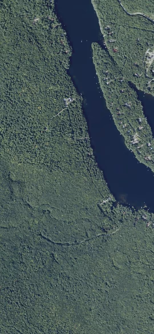
Draw polygon zones on satellite imagery. Edit vertices later, layer your own drone imagery on top.
Plot Designer
Sketch beds in inches, drag them to their real spot, and watch the footprint render to scale on the map.
Planting calendar
Frost dates from a decade of local weather set every crop's sow, transplant, and harvest window — and a 'plant now' strip tells you what to start this week.
Companion Planting
Live conflict checks as you place — severity-graded, with minimum-distance recommendations.
Plant journals
Every pin, zone, bed, and individual placement keeps its own timeline of waterings, harvests, photos.
Soil chemistry
Snap a lab report — AI parses pH / OM / NPK into per-zone sparklines and Muninn flags drift.
Reminders & tasks
Daily digest of watering checks, harvest windows, frost prompts — plus a tasks board for the whole crew.
Insights
Property dashboard rolls up totals, mortality flags, zone coverage, and recent activity at a glance.
Offline-first
GPS, tiles, pin drops, and event logs queue locally and replay the moment you're back online.
AI disease & pest ID, the Muninn AI advisor, a weather-driven irrigation advisor, in-field sensors, plant ID, voice scouting, yield & bloom forecasts, drone overlays, a local seed & scion exchange, team workspaces, harvest & spray logs, NDVI, REST API… see the full tour.
Most tools are built for someone else's land.
Garden apps assume a couch and a signal.
They're built for planning from the kitchen table on a live connection. Walk past the last cell tower and the pin you needed never saves.
Farm software is built for service businesses — and priced like it.
Spray-service and broadacre suites bill per acre or per seat for crews and compliance you may not have. The notebook stays cheaper, so the notebook wins.
Plottr is for the person who owns and walks the land.
Offline-first GPS, beds, soil, and years of plant history in one map — free to start, and it grows into a team workspace only if you ever need one.
Built for one stubborn 45-acre problem.
I planted hundreds of seedlings across a 45-acre Maine forest and lost track of half of them in notebooks and camera rolls. Plottr is the tool I wished existed — drop a GPS pin where you stand, and let every season build on the same record.
One map, tuned to your land.
Plan the kitchen garden and the back forty together.
Keep beds, soil tests, rotations, orchard rows, and woodland plantings in one map instead of splitting the season across notebooks and camera rolls.
Outgrew the notebook? Skip the enterprise price tag.
When a homestead or orchard grows into a livelihood, Plottr Business adds team seats, field operations, compliance records, spatial AI, and integrations — on the same map you already use. No per-acre contracts, no enterprise rollout.
Owner and editors are paid seats. Viewers are unlimited and free for buyers, advisors, landlords, or crew leads.
Tasks, spray records, harvest logs, inventory, REI / PHI windows, and audit-ready exports live next to the map.
Weather, NDVI, anomaly detection, and Muninn guidance turn mapped zones into an operating picture.
Connect Plottr to reporting tools, automations, dashboards, drone workflows, or custom farm software.
Pricing
Generous free tier. Pro for serious growers. Business for commercial operations.
Track one garden in detail.
- ✓1 property
- ✓1 GB photo storage
- ✓1 editor + unlimited viewers
- ✓Full map, plant catalog, plot designer
- ✓Reminders, exports, imports, drone overlays
- —AI features (soil parsing, plant ID, advisor chat, bed design)
Unlock AI, satellite & sensor intelligence, integrations, and 25× more storage.
- ✓Unlimited properties
- ✓25 GB photo storage
- ✓3 editors + unlimited viewers
- ✓100 AI actions / mo (soil, plant ID, advisor, bed design, voice)
- ✓Satellite NDVI, weather & frost / heat alerts
- ✓IoT sensors, anomaly detection & custom fields
- ✓Webhooks, iCal & Zapier integrations
Run a commercial operation: workspace teams, tasks, spray & harvest records, labor tracking, and compliance.
- ✓Everything in Pro, for every seat
- ✓Workspace teams · viewers free + unlimited
- ✓200 AI actions / seat / mo (pooled)
- ✓Tasks, spray records, REI / PHI tracking
- ✓Harvest log, inventory & equipment
- ✓Labor / time tracking
- ✓Compliance PDFs (GAP / NOP / FSMA / pesticide)
- ✓Custom roles + workspace-wide audit log
Secure checkout via Stripe · cancel anytime
Fly the trees you've planted.
Muninn is a drone mission planner from the same maker. Connect your Plottr account and it generates a per-plant capture flight — radius and altitude sized to each species — then auto-attaches the photos back to each plant's timeline. Same raven, different home.
- 1 Connect Plottr from inside Muninn
- 2 Pick a property or zone
- 3 Fly the auto-generated mission
- 4 Photos land on each plant's timeline
Map your land. Start free.
Sign up takes 30 seconds. Your photos and pins are yours forever — exportable any time.